INVILLINO BARRIER
WEST INVILLINO GROUP

Historical background and composition
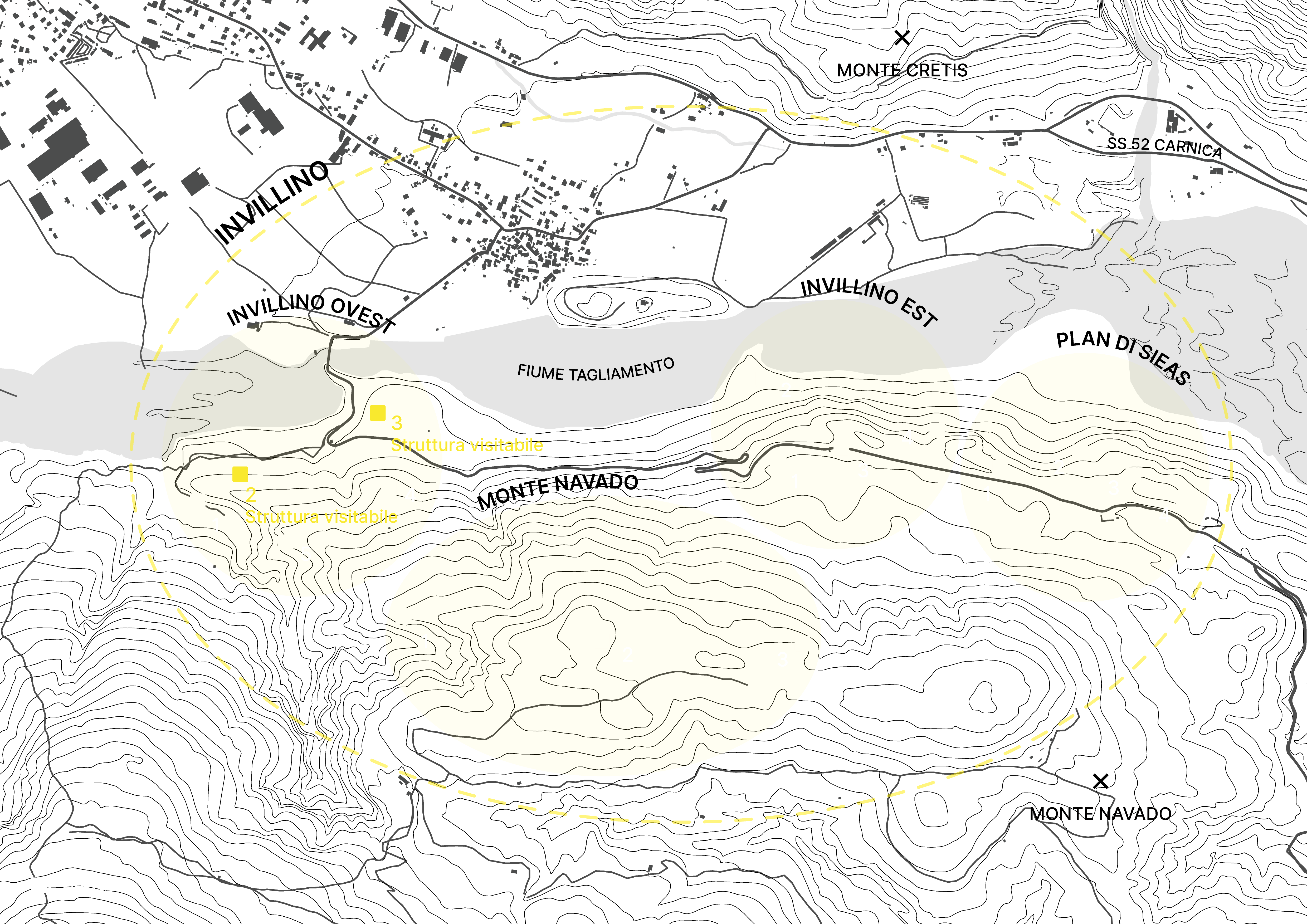
The Invillino barrier, located south of the hamlet by the same name of the municipality of Villa Santina, and on the northern slopes of Mount Navado, was built between 1940 and 1942 and was part of the Alpine Wall. This defence barrier included sixteen works in caves, which were divided into four groups: East Invillino, West Invillino, Mount Navado and Plan di Sieas. The works that can be visited today were part of the West Invillino group, which comprised a total of five works described below:
- work 1: it comprised four positions for machine guns;
- work 2 (this structure can be visited): it comprised six positions for machine guns;
- work 3 (this structure can be visited): it comprised two positions for an anti-tank guns and seven positions for machine guns, including a metal turret with four slits;
- work: 4: it was the main work and comprised five positions for machine guns;
- work 5: it comprised a shelter and a position for a machine gun.
None of these works was reactivated after the Second World War, which makes them the only original structures of the Alpine Wall that can be visited today in the Friuli Venezia Giulia region.
Purpose
The purpose of the barrier was to oversee the valley floor from the confluence of the Degano stream into the Tagliamento river, south-east of Villa Santina, to the locality Madonna del Sasso, about three kilometres from Tolmezzo.
Moreover, the purpose of some works of the East Invillino and West Invillino groups was to block the Invillino-Villa-Chiaulis road.
DIRECTIONS
The barrier is located south of the hamlet of Invillino in the municipality of Villa Santina (UD). Driving along State Road (S.S.) 52 “Carnica” towards Villa Santina, at the roundabout located at the entrance to Villa Santina take the second exit and cross the village of Invillino in the direction of Verzegnis. After crossing the Tagliamento river and reaching the locality of “Madonna del Ponte”, go along Provincial Road 72 for about 150 metres until you reach, on the right, a dirt road with a tourist sign that reads “Cascata Plera” (CAI 806 path); continue on foot along this road for another 150 metres, then you will see, on the right, work 2.
To reach work 3, located in the locality of “Viertide”, keep to the right the entrance to the dirt road (CAI 806 path) and continue along Provincial Road 72. Once you have passed a hairpin bend, after about one hundred metres you will come across, on the left, a track that enters the woods; continuing on foot along this path (unmarked) northward, you will be able to see the Tagliamento river, as well as the access trench to work 3 on the right.
OPENINGS TO THE PUBLIC
The structures open to the public can only be visited by contacting the volunteers of the Associazione Friuli Storia e Territorio.
CONTACTS
Associazione Friuli Storia e Territorio
museoguerrafredda@gmail.com
+39 334 2060560 (Walter), +39 335 7687694 (Roberto)
